

Laser scanning
In connection with the rapid development of BIM technology in the field of construction and design, the need for 3D surveying has also grown rapidly. We find that the most effective technology for this is laser scanning.
Our goal is to deliver laser scanning and surveying outputs with the required accuracy and with sufficient information for the needs. We believe that the benefits and gains from the laser scanning survey method are maximised by working closely with the customer to find out the exact needs of the project and then finding solutions tailored to the client.
Rapid surveying and suitable outputs
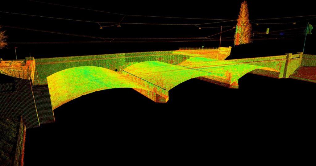
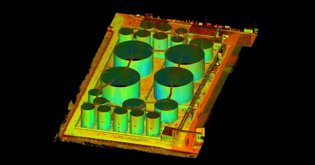
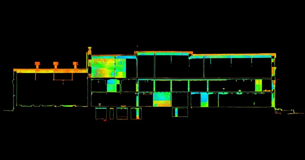
Laser scanning allows the collection of a very large volume of precise 3D information from project sites and the surrounding environment in a very short time. As a result of the survey, we obtain a data set of 3D points, i.e. a point cloud, on the basis of which we compile a 3D model, elevations, sections, plans, etc., if necessary.
Modern tools
Reaalprojekt uses a Leica ScanStation P20 to perform 3D surveying with updated software, which enables fast and very accurate measurements. The advantages of our scanner over others are cold resistance in below-zero temperatures and the possibility to measure inside storage tanks etc. The device also includes a digital camera, which allows colour information (RGB) to be added to the point cloud, if necessary.
We use modern software such as Leica Cyclone, Autodesk Revit, Autodesk Recap, AutoCAD Civil 3D and others for point cloud processing and modelling.
Long-term experience in the following areas:
- Buildings to be renovated
- Inventory
- Control measurements of new building structures
- Cultural heritage
- Infrastructure (bridges, tunnels, canals, lighthouses)
- Special features such as storage tanks, pipelines, equipment, etc.